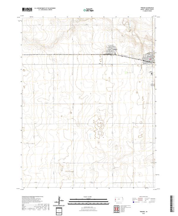
2022 Map of Tribune
USGS Topo · Published 2022About this map
The High Plains of western Kansas are defined here by the neighboring settlements of Tribune and Horace, which sit along the Horace-Tribune RD. As the seat of Greeley County, Tribune serves as the regional hub, anchored by the Greeley County Courthouse and a grid of streets including Kansas St and Broadway Ave. The landscape is largely structured by section lines and county roads, such as Co RD 13 and Co RD S, which partition the terrain for agricultural use. Natural features are scarce in this arid environment, with the ephemeral White Woman Cr providing the primary drainage to the northeast. To the south of the town center, the Tribune Municipal Airport and the Greely County Cem mark the transition from the concentrated residential blocks of the townships into the surrounding open range of the Kansas prairie.
Find a feature on this map
38 named features on this map. Tap any name to fly to it.
Don’t see what you’re looking for? This feature index may not catch every label — zoom into the map to look around manually.
Map Details
Editions of this 2022 Tribune Map
This is the sole edition of this map. No revisions or reprints were ever made.
Other maps of this area

1955 · Scott City
USGS Topo · 1:250,000

1958 · Scott City
USGS Topo · 1:250,000

1970 · Selkirk SW
USGS Topo · 1:24,000

1970 · Sharon Springs 3 SE
USGS Topo · 1:24,000

1970 · Sharon Springs 4 SW
USGS Topo · 1:24,000
1970 · Sharon Springs 3 SW
USGS Topo · 1:24,000

1970 · Selkirk NW
USGS Topo · 1:24,000
1970 · Tribune NW
USGS Topo · 1:24,000

1970 · Tribune SE
USGS Topo · 1:24,000
1970 · Tribune SW
USGS Topo · 1:24,000