
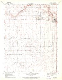
1970 Map of Tribune SE
USGS Topo · Published 1972About this map
Richland and Harrison townships define the southern reaches of this high plains landscape, where the flat terrain is cut by the winding course of Mattox Draw. This 1970 field-checked survey reveals an area largely shaped by agriculture and the emerging energy sector, specifically noted by several Gas Well sites near the southern boundary. In the northwestern corner, Tuttle Landing Field represents the local aviation infrastructure of the era. The map clearly delineates the administrative transition between Greeley and Hamilton counties, providing a clear record of the rural land divisions and township boundaries like Colony that organized this portion of Western Kansas during the late twentieth century.
Find a feature on this map
7 named features on this map. Tap any name to fly to it.
Don’t see what you’re looking for? This feature index may not catch every label — zoom into the map to look around manually.
Map Details
Editions of this 1970 Tribune SE Map
This is the sole edition of this map. No revisions or reprints were ever made.
Other maps of this area

1955 · Scott City
USGS Topo · 1:250,000

1958 · Scott City
USGS Topo · 1:250,000

1966 · Tribune 4 NW
USGS Topo · 1:24,000
1966 · Tribune 3 NE
USGS Topo · 1:24,000
1966 · Tribune 3 NW
USGS Topo · 1:24,000

1970 · Selkirk SW
USGS Topo · 1:24,000

1970 · Selkirk NW
USGS Topo · 1:24,000
1970 · Tribune NW
USGS Topo · 1:24,000
1970 · Tribune SW
USGS Topo · 1:24,000
1970 · Tribune
USGS Topo · 1:24,000