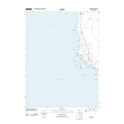
2012 Map of Trinidad
USGS Topo · Published 2012About this map
Trinidad sits at the heart of this coastal study, where the Pacific coastline meets the redwood-forested hills of Humboldt County. The settlement is anchored by the landmark Trinidad Head Lighthouse on Trinidad Head, overlooking the sheltered waters of Trinidad Harbor and Trinidad Bay. The map details the complex shoreline geography, marked by numerous sea stacks and rocky outcrops such as Blank Rock, Prisoner Rock, and Camel Rock. Inland, the terrain rises toward Candy Mountain, crossed by local routes like McConnahas Mill Rd and Creamery Rd that hint at the region's agricultural and timber history. North of the main town, Trinidad State Bch and Patricks Point define the recreational and natural character of the coast, while the drainage of Mill Cr and McNeil Cr carves through the coastal terrace.
Find a feature on this map
45 named features on this map. Tap any name to fly to it.
Don’t see what you’re looking for? This feature index may not catch every label — zoom into the map to look around manually.
Map Details
Editions of this 2012 Trinidad Map
This is the sole edition of this map. No revisions or reprints were ever made.
Other maps of this area

1922 · Eureka
USGS Topo · 1:62,500

1933 · Eureka
USGS Topo · 1:48,000

1942 · Eureka
USGS Topo · 1:62,500

1945 · Trinidad
USGS Topo · 1:62,500

1949 · Eureka
USGS Topo · 1:250,000

1951 · Eureka
USGS Topo · 1:62,500
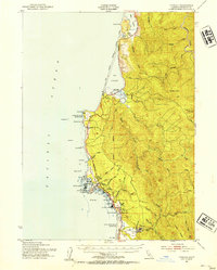
1952 · Trinidad
USGS Topo · 1:62,500
1952 · Arcata North
USGS Topo · 1:24,000

1958 · Eureka
USGS Topo · 1:250,000
1958 · Crescent City
USGS Topo · 1:250,000