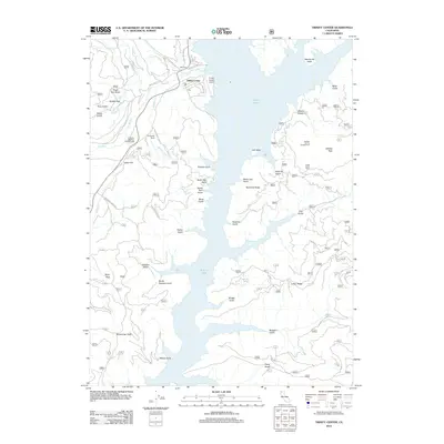
2022 Map of Trinity Center
USGS Topo · Published 2022About this map
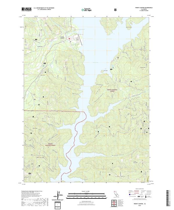
Trinity Center occupies a critical position on the western shore of Trinity Lake, serving as a gateway to the surrounding wilderness of the Shasta National Forest and Trinity National Forest. This modern survey reveals a landscape of high ridges and deep drainages, where the Trinity Center Airport provides essential access to this mountainous terrain. The terrain is defined by dramatic elevation changes, rising from the waters of the lake to significant heights at Billys Peak and Bowerman Peak. The mapping detail captures the complex drainage systems of Swift Cr and Rancheria Cr, while unique topographical features like the Irish Isles and Rackerby Ridge punctuate the lake’s shoreline and interior. The network of Forest Service roads, including 37n55 and 36n10, illustrates the modern infrastructure used to navigate the rugged Bowerman Ridge and the various gulches that carve into the Trinity Mountains.
Find a feature on this map
114 named features on this map. Tap any name to fly to it.
Don’t see what you’re looking for? This feature index may not catch every label — zoom into the map to look around manually.
Map Details
Editions of this 2022 Trinity Center Map
This is the sole edition of this map. No revisions or reprints were ever made.
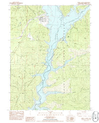
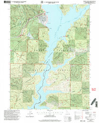
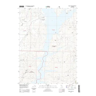
Historical Maps of Trinity Center Through Time
6 maps found