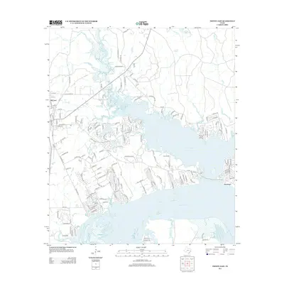
2013 Map of Trinity East
USGS Topo · Published 2013About this map
Livingston Reservoir dominates this East Texas landscape, its expansive waters defining the geography of eastern Trinity, Texas. This 2013 survey illustrates how modern residential development has adapted to the shoreline, with neighborhoods like White Rock Acres and Cherry Hls situated near the water's edge. The settlement of Sebastopol stands on the southeastern shore, while Mill Town occupies the western edge of the quadrangle. Historical continuity is visible at Taylor Cemetery and several family-named roads, including Jack Scheffer Rd and Ben Blair Rd. The terrain is shaped by numerous tributaries such as Sandy Cr and Shoemake Cr, while Ehni Airport and Grand Rock Pt serve as distinct landmarks along the reservoir's irregular coast.
Find a feature on this map
162 named features on this map. Tap any name to fly to it.
Don’t see what you’re looking for? This feature index may not catch every label — zoom into the map to look around manually.
Map Details
Editions of this 2013 Trinity East Map
This is the sole edition of this map. No revisions or reprints were ever made.
Other maps of this area

1953 · Palestine
USGS Topo · 1:250,000

1954 · Beaumont
USGS Topo · 1:250,000

1957 · Beaumont
USGS Topo · 1:250,000

1957 · Palestine
USGS Topo · 1:250,000

1960 · Trinity West
USGS Topo · 1:24,000

1960 · Trinity East
USGS Topo · 1:24,000

1960 · Carlisle
USGS Topo · 1:24,000

1961 · Staley
USGS Topo · 1:24,000

1961 · Riverside
USGS Topo · 1:24,000

1962 · Lovelady South
USGS Topo · 1:24,000