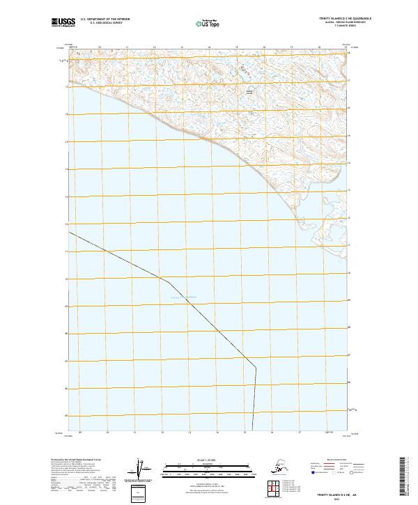
2021 Map of Trinity Islands D-2 NE
USGS Topo · Published 2021About this map
Kodiak Island occupies the northern reaches of this coastal survey, where the terrestrial landscape meets the open waters of the Gulf of Alaska. The terrain is defined by a sparse, maritime environment, largely concentrated around the indentation of Sukhoi Bay in the northeast. This 2021 edition reflects the remote character of the region, where the Public Land Survey System grid lines, including t37s r32w and t37s r33w, trace over a landscape devoid of developed roads or settlements. The focus remains on the natural boundary where the island's low-lying coastal features give way to the expansive gulf, providing a modern topographical baseline for this portion of the Kodiak Archipelago.
Find a feature on this map
6 named features on this map. Tap any name to fly to it.
Don’t see what you’re looking for? This feature index may not catch every label — zoom into the map to look around manually.
Map Details
Editions of this 2021 Trinity Islands D-2 NE Map
This is the sole edition of this map. No revisions or reprints were ever made.
Other maps of this area

1951 · Trinity Islands
USGS Topo · 1:250,000

1951 · Karluk
USGS Topo · 1:250,000

1952 · Karluk
USGS Topo · 1:250,000

1952 · Trinity Islands D-2
USGS Topo · 1:63,360

1952 · Trinity Islands D-1
USGS Topo · 1:63,360

1952 · Karluk A-1
USGS Topo · 1:63,360

1952 · Karluk A-2
USGS Topo · 1:63,360
1954 · Karluk A-1
USGS Topo · 1:63,360
1954 · Trinity Islands D-1
USGS Topo · 1:63,360
1954 · Karluk A-2
USGS Topo · 1:63,360