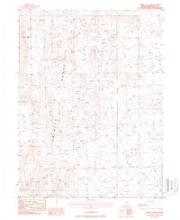
1987 Map of Trinity Peak
USGS Topo · Published 1988About this map
Trinity Range dominates this Pershing County landscape, rising to its highest point at Trinity Peak. The high-desert terrain is defined by a sparse infrastructure of resource extraction and water management. Isolated Prospect sites and Prospects dot the slopes, marking the ongoing search for minerals in this part of Nevada during the 1980s. Water access is critical in this arid environment, noted by Lowry Well and several Guzzler installations designed for wildlife. Modern utility corridors, including a Pipeline and Trans Line, cut across the lower elevations, while a network of 4 WD tracks provides the only access into the steeper interior canyons of the range.
Find a feature on this map
10 named features on this map. Tap any name to fly to it.
Don’t see what you’re looking for? This feature index may not catch every label — zoom into the map to look around manually.
Map Details
Editions of this 1987 Trinity Peak Map
This is the sole edition of this map. No revisions or reprints were ever made.
Other maps of this area

1931 · Lovelock
USGS Topo · 1:250,000

1935 · Lovelock
USGS Topo · 1:250,000

1955 · Lovelock
USGS Topo · 1:250,000

1956 · Toulon
USGS Topo · 1:62,500

1959 · Lovelock
USGS Topo · 1:250,000
1981 · Ragged Top Mtn
USGS Topo · 1:24,000

1981 · Trinity Pass
USGS Topo · 1:24,000

1981 · Poker Brown Spring
USGS Topo · 1:24,000
1981 · Lowry Well
USGS Topo · 1:24,000
1981 · Seven Troughs SE
USGS Topo · 1:24,000