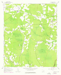
1943 Map of Trio
USGS Topo · Published 1976About this map
Trio serves as a central hub in this landscape, where the Seaboard Coast Line railroad cuts through the low-lying swamps of Williamsburg County. The map reveals a land dominated by large, distinct bays—depressions in the Atlantic coastal plain—such as Wittee Bay, Alligator Bay, and Ricefield Bay. These features, alongside Spring Valley Swamp and Murray Swamp, dictate the placement of local infrastructure, forcing settlements and roads onto higher ground like Big Ridge and Cross Bay Ridge.
Find a feature on this map
38 named features on this map. Tap any name to fly to it.
Don’t see what you’re looking for? This feature index may not catch every label — zoom into the map to look around manually.
Map Details
Editions of this 1943 Trio Map
2 editions found
Other maps of this area

1942 · Cedar Creek
USGS Topo · 1:24,000

1943 · Trio
USGS Topo · 1:24,000

1943 · Andrews
USGS Topo · 1:24,000

1943 · Jamestown
USGS Topo · 1:24,000

1943 · Bonneau
USGS Topo · 1:62,500

1946 · Kingstree
USGS Topo · 1:62,500

1946 · Indiantown
USGS Topo · 1:62,500

1949 · Georgetown
USGS Topo · 1:250,000

1967 · Georgetown
USGS Topo · 1:250,000

1974 · Georgetown
USGS Topo · 1:250,000