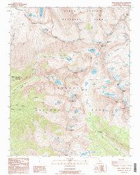
1993 Map of Triple Divide Peak
USGS Topo · Published 1994About this map
The Great Western Divide serves as the backbone of this high-altitude landscape, where the headwaters of the Kern-Kaweah River and Middle Fork Kaweah River originate. The 1993 topography reveals a network of high-country infrastructure critical to the Sierra Nevada backcountry, including the Bearpaw Meadow Ranger Station and the Bearpaw Meadow High Sierra Camp. These sites, along with the Old Big Arroyo Patrol Cabin, represent the long-standing management and recreational history of Sequoia National Park and Kings Canyon National Park.
Find a feature on this map
53 named features on this map. Tap any name to fly to it.
Don’t see what you’re looking for? This feature index may not catch every label — zoom into the map to look around manually.
Map Details
Editions of this 1993 Triple Divide Peak Map
2 editions found
Other maps of this area

1903 · Tehipite
USGS Topo · 1:125,000

1904 · Kaweah
USGS Topo · 1:125,000

1905 · Tehipite
USGS Topo · 1:125,000

1905 · Olancha
USGS Topo · 1:125,000

1907 · Olancha
USGS Topo · 1:125,000

1907 · Mt. Whitney
USGS Topo · 1:125,000

1909 · Kaweah
USGS Topo · 1:125,000

1919 · Mt. Whitney
USGS Topo · 1:125,000

1937 · Mt. Whitney
USGS Topo · 1:125,000

1937 · Kaweah
USGS Topo · 1:125,000