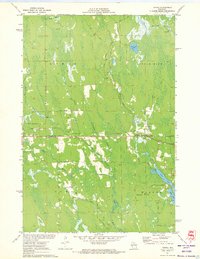
1971 Map of Tripoli
USGS Topo · Published 1973About this map
The Soo Line railroad cuts a sharp horizontal line through this north-central Wisconsin landscape, passing through the settlement of Tripoli near the border of Oneida and Lincoln counties. This survey, field-checked in the early 1970s, captures a transition between the organized townships of Lynne, Little Rice, Wilson, and Somo. The terrain is defined by a dense network of waterways, including the Somo River and Little Rice River, which feed into the large basin of Somo Lake in the southeast.
Find a feature on this map
40 named features on this map. Tap any name to fly to it.
Don’t see what you’re looking for? This feature index may not catch every label — zoom into the map to look around manually.
Map Details
Editions of this 1971 Tripoli Map
This is the sole edition of this map. No revisions or reprints were ever made.
Other maps of this area

1939 · Mc Cord
USGS Topo · 1:48,000

1941 · Brantwood
USGS Topo · 1:48,000

1943 · Brantwood
USGS Topo · 1:48,000

1945 · Rib Lake
USGS Topo · 1:48,000

1947 · Mc Cord
USGS Topo · 1:48,000

1947 · Rib Lake
USGS Topo · 1:48,000

1949 · Rib Lake
USGS Topo · 1:48,000

1950 · Spirit Falls
USGS Topo · 1:48,000

1952 · Spirit Falls
USGS Topo · 1:48,000

1953 · Rice Lake
USGS Topo · 1:250,000