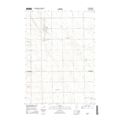
2015 Map of Tripp
USGS Topo · Published 2015About this map
Tripp serves as the primary hub for this agricultural portion of the prairie, situated at the intersection of Highway 37 and Highway 18. The landscape is defined by the winding paths of Emanuel Cr and Dawson Cr, which weave through the section lines of the Public Land Survey System. For genealogists and local historians, the sheet is particularly dense with pioneer burial sites that reflect the area's denominational history and early settlement patterns. These include the Friedens Cem, Holy Rosary Cem, and Grace Hill Cem near the town center, as well as more outlying sites such as Zion Cem to the west and the Hoffnungstal Cem to the east. Farther south, near Snatch Cr, lies the Saints Cyril and Methodius Cem, marking the rural spiritual centers that anchored these farming communities across both Hutchinson and Bon Homme counties.
Find a feature on this map
32 named features on this map. Tap any name to fly to it.
Don’t see what you’re looking for? This feature index may not catch every label — zoom into the map to look around manually.
Map Details
Editions of this 2015 Tripp Map
This is the sole edition of this map. No revisions or reprints were ever made.
Other maps of this area

1898 · Olivet
USGS Topo · 1:125,000

1955 · Sioux Falls
USGS Topo · 1:250,000

1955 · Mitchell
USGS Topo · 1:250,000

1958 · Sioux Falls
USGS Topo · 1:250,000

1959 · Mitchell
USGS Topo · 1:250,000

1977 · Oak Hollow
USGS Topo · 1:24,000

1978 · Tripp SE
USGS Topo · 1:24,000

1978 · Oak Hollow
USGS Topo · 1:24,000
1978 · Haucks Lake
USGS Topo · 1:24,000
1978 · Kaylor
USGS Topo · 1:24,000