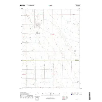
2017 Map of Tripp
USGS Topo · Published 2017About this map
Tripp serves as the primary hub of this rural landscape, situated at the intersection of a vast grid of local roads and several meandering waterways. The town's layout is centered on S Main St, W Depot St, and E Dakota St, illustrating the traditional Midwestern settlement pattern where rail or road corridors dictated municipal growth. The map reveals a dense concentration of religious and genealogical sites surrounding the town, including Friedens Reformed Cem, Cathedral Cem, and Grace Hill Cem, all clustered just south of the town center.
Find a feature on this map
36 named features on this map. Tap any name to fly to it.
Don’t see what you’re looking for? This feature index may not catch every label — zoom into the map to look around manually.
Map Details
Editions of this 2017 Tripp Map
This is the sole edition of this map. No revisions or reprints were ever made.
Other maps of this area

1898 · Olivet
USGS Topo · 1:125,000

1955 · Sioux Falls
USGS Topo · 1:250,000

1955 · Mitchell
USGS Topo · 1:250,000

1958 · Sioux Falls
USGS Topo · 1:250,000

1959 · Mitchell
USGS Topo · 1:250,000

1977 · Oak Hollow
USGS Topo · 1:24,000

1978 · Tripp SE
USGS Topo · 1:24,000

1978 · Oak Hollow
USGS Topo · 1:24,000
1978 · Haucks Lake
USGS Topo · 1:24,000
1978 · Kaylor
USGS Topo · 1:24,000