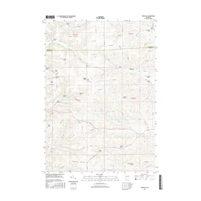
2016 Map of Trippville
USGS Topo · Published 2016About this map
Mount Tabor and the namesake Trippville anchor this 2016 survey of the driftless landscape along the border of Vernon and Monroe counties. The area is defined by a dense network of coulees and ridges, including Fairview Ridge and Burr Ridge, which dictate the winding paths of rural routes like Co Hwy V and Mount Tabor Rd. Settlement patterns follow the valley floors where Hills Cr and the W Br Baraboo River have carved distinct terrain features such as Cox Valley and Johnnycake Hollow. Numerous burial grounds, including the Bohemian Brotherhood Cem and Saint Joseph Cem, speak to the deep-rooted heritage of the surrounding farming communities. In the southern portion of the quadrangle, the small settlement of Dilly sits near the headwaters of Dilly Cr, illustrating the long-standing reliance on local creek systems for early placement and irrigation.
Find a feature on this map
92 named features on this map. Tap any name to fly to it.
Don’t see what you’re looking for? This feature index may not catch every label — zoom into the map to look around manually.
Map Details
Editions of this 2016 Trippville Map
This is the sole edition of this map. No revisions or reprints were ever made.
Other maps of this area

1916 · Tomah
USGS Topo · 1:62,500

1919 · Kendall
USGS Topo · 1:62,500

1921 · Kendall
USGS Topo · 1:62,500

1926 · La Farge
USGS Topo · 1:62,500

1927 · Hillsboro
USGS Topo · 1:62,500

1949 · Tomah
USGS Topo · 1:62,500

1958 · La Crosse
USGS Topo · 1:250,000

1961 · La Crosse
USGS Topo · 1:250,000

1962 · Kendall
USGS Topo · 1:62,500

1965 · La Crosse
USGS Topo · 1:250,000