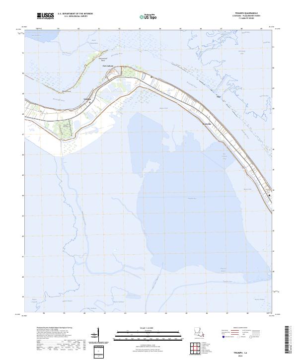
2024 Map of Triumph
USGS Topo · Published 2024About this map
Fort Jackson stands as a prominent sentinel on the western bank of the Mississippi River near Plaquemines Bend, anchoring this corner of the Louisiana delta. The landscape is defined by the thin ribbon of habitable ground between the river's levee and the encroaching marshlands. Linear settlements like Triumph, Boothville, and Olga follow the curve of the river, connected by Boothville River Rd and protected by the massive earthen works along Levee Rd. The infrastructure here, including the Triumph Pump Sta and the Buras Drainage Canal, highlights the constant engineering required to maintain these riverine communities. Beyond the levees, the map reveals a complex network of coastal waterways and brackish basins such as Bay Denesse and Old Stump Lake, illustrating the fragile transition from the river's high ground into the Gulf of Mexico.
Find a feature on this map
45 named features on this map. Tap any name to fly to it.
Don’t see what you’re looking for? This feature index may not catch every label — zoom into the map to look around manually.
Map Details
Editions of this 2024 Triumph Map
This is the sole edition of this map. No revisions or reprints were ever made.
Other maps of this area

1892 · Quarantine
USGS Topo · 1:62,500

1893 · Forts
USGS Topo · 1:62,500

1893 · West Delta
USGS Topo · 1:62,500

1935 · Taylor Pass
USGS Topo · 1:31,680

1935 · Tropical Bend
USGS Topo · 1:31,680

1941 · Empire
USGS Topo · 1:62,500

1944 · Empire
USGS Topo · 1:62,500

1946 · Pass Tante Phine
USGS Topo · 1:31,680

1947 · Buras
USGS Topo · 1:31,680

1947 · Venice
USGS Topo · 1:31,680