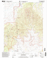
2002 Map of Tropic Canyon
USGS Topo · Published 2005About this map
Tropic sits at the southern base of the Pink Cliffs, where the arid basin of Tropic Valley meets the dramatic rising topography of the Paunsaugunt Plateau. This area serves as a critical geographic junction between the Dixie National Forest and the Grand Staircase-Escalante National Monument, following the course of the Paria River and Henderson Creek. The landscape is defined by its extreme verticality, featuring named landmarks such as Shakespear Point, the Sinking Ship formation, and the Mossy Cave area within Bryce Canyon. The presence of the All American Highway cutting through Tropic Canyon illustrates the region's mid-century transition into a major destination for travelers, while a lonely Cem near the town center provides a point of interest for local genealogists and historians.
Find a feature on this map
59 named features on this map. Tap any name to fly to it.
Don’t see what you’re looking for? This feature index may not catch every label — zoom into the map to look around manually.
Map Details
Editions of this 2002 Tropic Canyon Map
This is the sole edition of this map. No revisions or reprints were ever made.
Other maps of this area

1886 · Kanab
USGS Topo · 1:250,000

1886 · Escalante
USGS Topo · 1:250,000

1953 · Cedar City
USGS Topo · 1:250,000

1956 · Escalante
USGS Topo · 1:250,000

1958 · Cedar City
USGS Topo · 1:250,000

1960 · Escalante
USGS Topo · 1:250,000

1962 · Cedar City
USGS Topo · 1:250,000

1964 · Henrieville
USGS Topo · 1:24,000
1964 · Sweetwater Creek
USGS Topo · 1:24,000
1964 · Pine Lake
USGS Topo · 1:24,000