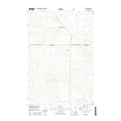
2014 Map of Trotters
USGS Topo · Published 2014About this map
The unincorporated community of Trotters sits along State Hwy 16 in this high plains landscape of Golden Valley and McKenzie counties. Located within the Little Missouri National Grassland, the terrain is defined by a complex network of ephemeral drainages, including N Fork Smith Cr, S Fork Smith Cr, and Horse Cr. These watercourses carve through the rolling badlands, creating a geography that dictates the placement of rural roads and remote homesteads.
Find a feature on this map
18 named features on this map. Tap any name to fly to it.
Don’t see what you’re looking for? This feature index may not catch every label — zoom into the map to look around manually.
Map Details
Editions of this 2014 Trotters Map
This is the sole edition of this map. No revisions or reprints were ever made.
Other maps of this area

1909 · Glendive
USGS Topo · 1:250,000

1953 · Watford City
USGS Topo · 1:250,000

1954 · Glendive
USGS Topo · 1:250,000

1957 · Glendive
USGS Topo · 1:250,000

1957 · Watford City
USGS Topo · 1:250,000

1958 · Glendive
USGS Topo · 1:250,000

1967 · Watford City
USGS Topo · 1:250,000

1974 · Hootowl Creek West
USGS Topo · 1:24,000

1974 · Trotters SE
USGS Topo · 1:24,000

1974 · Trotters
USGS Topo · 1:24,000