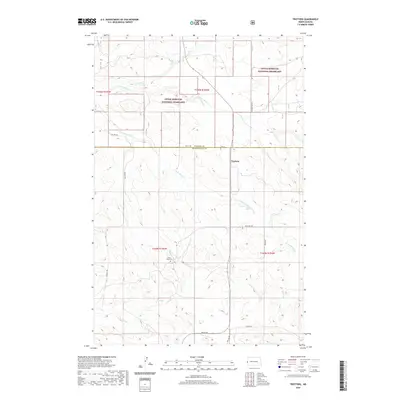
2020 Map of Trotters
USGS Topo · Published 2020About this map
Little Missouri National Grassland dominates this portion of the North Dakota badlands, where the high plains break into a complex network of drainage's. The small community of Trotters sits near the border of McKenzie and Golden Valley Counties, serving as a remote outpost in a landscape defined by ranching and public lands. A network of section-line roads, including Vinquist Rd and Pearl Rd, provides access to isolated homesteads and grazing allotments across the rolling terrain. Local history is anchored at the South Side Cem, while the geography is carved by the winding paths of N Fork Smith Cr and Horse Cr. The map illustrates the persistent 1:24,000 scale grid of the American West, where the Public Land Survey System creates a rigid framework over the fluid, eroded topography of the Little Missouri basin.
Find a feature on this map
23 named features on this map. Tap any name to fly to it.
Don’t see what you’re looking for? This feature index may not catch every label — zoom into the map to look around manually.
Map Details
Editions of this 2020 Trotters Map
This is the sole edition of this map. No revisions or reprints were ever made.
Other maps of this area

1909 · Glendive
USGS Topo · 1:250,000

1953 · Watford City
USGS Topo · 1:250,000

1954 · Glendive
USGS Topo · 1:250,000

1957 · Glendive
USGS Topo · 1:250,000

1957 · Watford City
USGS Topo · 1:250,000

1958 · Glendive
USGS Topo · 1:250,000

1967 · Watford City
USGS Topo · 1:250,000

1974 · Hootowl Creek West
USGS Topo · 1:24,000

1974 · Trotters SE
USGS Topo · 1:24,000

1974 · Trotters
USGS Topo · 1:24,000