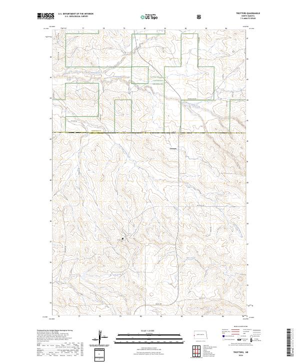
2024 Map of Trotters
USGS Topo · Published 2024About this map
Little Missouri National Grassland dominates the northern landscape of this region, where the badlands topography is carved by the North Fork Smith Creek and its many tributaries. The settlement of Trotters sits just south of the McKenzie and Golden Valley County line, serving as a remote waypoint in a vast expanse of section lines and gravel roads. To the south, the South Side Cem remains a quiet landmark of early prairie life near the banks of the South Fork Smith Creek. The local transportation network is defined by functional routes such as Beach Rd, Blacktail Rd, and Tescher Rd, which provide access through the complex drainage basins of Horse Creek and G S Creek. This modern survey illustrates the enduring patterns of ranching and conservation in the North Dakota grasslands.
Find a feature on this map
21 named features on this map. Tap any name to fly to it.
Don’t see what you’re looking for? This feature index may not catch every label — zoom into the map to look around manually.
Map Details
Editions of this 2024 Trotters Map
This is the sole edition of this map. No revisions or reprints were ever made.
Other maps of this area

1909 · Glendive
USGS Topo · 1:250,000

1953 · Watford City
USGS Topo · 1:250,000

1954 · Glendive
USGS Topo · 1:250,000

1957 · Glendive
USGS Topo · 1:250,000

1957 · Watford City
USGS Topo · 1:250,000

1958 · Glendive
USGS Topo · 1:250,000

1967 · Watford City
USGS Topo · 1:250,000

1974 · Hootowl Creek West
USGS Topo · 1:24,000

1974 · Trotters SE
USGS Topo · 1:24,000

1974 · Trotters
USGS Topo · 1:24,000