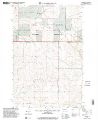
1997 Map of Trotters
USGS Topo · Published 2001About this map
The Little Missouri National Grassland dominates this portion of the North Dakota badlands, where the landscape is defined by the winding drainages of North Fork Smith Creek and Horse Creek. In the late 20th century, this area of McKenzie and Golden Valley Counties remained a sparsely populated ranching territory. Scattered homesteads and operations like Gorrell Ranch and Tasker Ranch are the primary markers of human settlement across the breaks.
Find a feature on this map
17 named features on this map. Tap any name to fly to it.
Don’t see what you’re looking for? This feature index may not catch every label — zoom into the map to look around manually.
Map Details
Editions of this 1997 Trotters Map
This is the sole edition of this map. No revisions or reprints were ever made.
Other maps of this area

1909 · Glendive
USGS Topo · 1:250,000

1953 · Watford City
USGS Topo · 1:250,000

1954 · Glendive
USGS Topo · 1:250,000

1957 · Glendive
USGS Topo · 1:250,000

1957 · Watford City
USGS Topo · 1:250,000

1958 · Glendive
USGS Topo · 1:250,000

1967 · Watford City
USGS Topo · 1:250,000

1974 · Hootowl Creek West
USGS Topo · 1:24,000

1974 · Trotters SE
USGS Topo · 1:24,000

1974 · Trotters
USGS Topo · 1:24,000