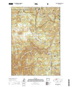
2020 Map of Trout Meadows
USGS Topo · Published 2020About this map
The North Fork John Day Wild and Scenic River carves a deep valley through the high timberland of the Blue Mountains, marking a sharp transition in the landscape of eastern Oregon. This 2020 survey highlights a region defined by extensive forest management and backcountry recreation, split between the Whitman National Forest and the Umatilla National Forest. High-altitude clearings such as Trout Meadows, Cabell Meadow, and Crane Flats offer rare open spaces amidst the dense canopy, while prominent landforms like White Pine Knob and Trout Meadows Butte overlook the drainage systems of Trout Cr and Meadow Cr. The map reveals a specialized winter transportation network, including the Ukiah-Granite Road 52 (Snow) and the Elkhorn Drive Snowmobile (Snow), which connect these high-country meadows when heavy snow closes standard access. This modern survey is an essential tool for understanding the contemporary topography of the Union and Grant county line.
Find a feature on this map
39 named features on this map. Tap any name to fly to it.
Don’t see what you’re looking for? This feature index may not catch every label — zoom into the map to look around manually.
Map Details
Editions of this 2020 Trout Meadows Map
This is the sole edition of this map. No revisions or reprints were ever made.
Other maps of this area

1901 · Sumpter
USGS Topo · 1:125,000

1951 · Desolation Butte
USGS Topo · 1:62,500

1953 · Pendleton
USGS Topo · 1:250,000

1955 · Canyon City
USGS Topo · 1:250,000

1956 · Pendleton
USGS Topo · 1:250,000

1959 · Canyon City
USGS Topo · 1:250,000

1965 · Limber Jim Creek
USGS Topo · 1:24,000

1965 · Fly Valley
USGS Topo · 1:24,000

1967 · Tower Mtn
USGS Topo · 1:24,000

1972 · Trout Meadows
USGS Topo · 1:24,000