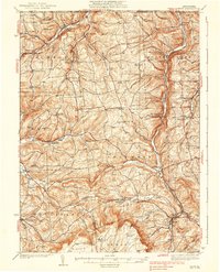
1938 Map of Troy
USGS Topo · Published 1938About this map
The Pennsylvania New York Boundary Line defines the northern edge of this northern Bradford County landscape, where the ridges of the Allegheny Plateau transition into the deep valleys of South Creek and Seely Creek. In the 1930s, this region was a network of small agricultural hubs and rail stops, most notably Columbia Cross Roads and Millerton. The eastern valley is dominated by the Pennsylvania RR, which parallels the South Creek through settlements like Gillett and Fassett. To the west, the winding paths of Sugar Creek and its branches supported communities like Sylvania and Austinville. This topographic study reveals a deeply settled rural interior, preserved before modern highway expansions, where local life centered on family-named landmarks like Judson Hill and Rowley Hill, and community institutions such as the Baptist Hill Ch and several country schoolhouses like Grey Valley Sch.
Find a feature on this map
77 named features on this map. Tap any name to fly to it.
Don’t see what you’re looking for? This feature index may not catch every label — zoom into the map to look around manually.
Map Details
Editions of this 1938 Troy Map
Other maps of this area

1895 · Elmira
USGS Topo · 1:62,500

1900 · Tioga
USGS Topo · 1:62,500

1902 · Waverly
USGS Topo · 1:62,500

1902 · Tioga
USGS Topo · 1:62,500

1905 · Watkins Glen
USGS Topo · 1:125,000

1914 · Corning
USGS Topo · 1:62,500

1925 · Blossburg
USGS Topo · 1:62,500

1927 · Blossburg
USGS Topo · 1:62,500

1931 · Troy
USGS Topo · 1:48,000

1938 · Troy
USGS Topo · 1:62,500