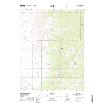
2018 Map of Troy Canyon
USGS Topo · Published 2018About this map
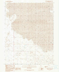
Troy Canyon and the high peaks of the Grant Range dominate this interior Nevada landscape within the Humboldt National Forest. The geography is defined by a series of steep drainage systems, including Irwin Canyon, Scofield Canyon, and Rimrock Canyon, which cut through the carbonate rock of the range toward the desert floor. The presence of Midland Trail Rd in the northwest corner provides a link to historical transcontinental travel routes, while Natl Forest Develop Road 420 Rd offers deeper access into the mountain interior. Water sources are critical but sparse, marked by features such as Ox Spring and its associated Ox Spring Wash, alongside seasonal flows like Little Meadows Cr and Bordoli Cr. This 2018 survey details the high-elevation terrain around Troy Peak, capturing the primitive road networks used by ranchers and hunters in this part of Nye County.
Find a feature on this map
24 named features on this map. Tap any name to fly to it.
Don’t see what you’re looking for? This feature index may not catch every label — zoom into the map to look around manually.
Map Details
Editions of this 2018 Troy Canyon Map
This is the sole edition of this map. No revisions or reprints were ever made.
Other maps of this area

1956 · Lund
USGS Topo · 1:250,000

1960 · Lund
USGS Topo · 1:250,000

1964 · Troy Canyon
USGS Topo · 1:62,500

1964 · Forest Home
USGS Topo · 1:62,500

1985 · Adaven
USGS Topo · 1:24,000
1985 · Water Gap NW
USGS Topo · 1:24,000
1985 · Nyala
USGS Topo · 1:24,000

1988 · Quinn Canyon Range
USGS Topo · 1:100,000
1990 · Troy Canyon
USGS Topo · 1:24,000
1990 · Christian Spring
USGS Topo · 1:24,000