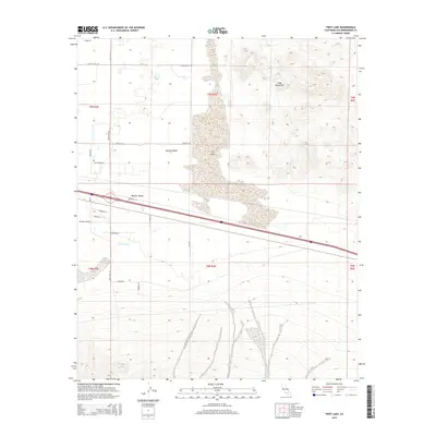
2015 Map of Troy Lake
USGS Topo · Published 2015About this map
Troy Lake dominates the central basin of this arid landscape, situated within the wider expanse of the Mojave Desert. The topography is defined by the stark rise of the Cady Mountains to the northeast, casting a shadow over the low-lying Mojave Valley. This area represents a classic desert drainage system, where the seasonal Kane Wash flows toward the playa, and a grid of rural desert roads provides access to the scattered parcels south of the lake. These routes, including Fort Cady Rd and Silver Valley Rd, reveal the spread of rural development into the high desert during the early 21st century. The map provides a detailed view of section lines and township boundaries like t9n r4e, illustrating how the Public Land Survey System has organized this environment for residential and agricultural efforts such as those near Palo Verde Ln.
Find a feature on this map
27 named features on this map. Tap any name to fly to it.
Don’t see what you’re looking for? This feature index may not catch every label — zoom into the map to look around manually.
Map Details
Editions of this 2015 Troy Lake Map
This is the sole edition of this map. No revisions or reprints were ever made.
Other maps of this area

1953 · San Bernardino
USGS Topo · 1:250,000

1955 · Silver Bell Mine
USGS Topo · 1:24,000

1955 · Sunshine Peak
USGS Topo · 1:24,000

1955 · Newberry
USGS Topo · 1:62,500

1955 · Lavic
USGS Topo · 1:62,500

1955 · Cady Mountains
USGS Topo · 1:62,500

1955 · Rodman Mountains
USGS Topo · 1:62,500

1956 · San Bernardino
USGS Topo · 1:250,000

1957 · San Bernardino
USGS Topo · 1:250,000

1958 · San Bernardino
USGS Topo · 1:250,000