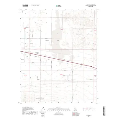
2021 Map of Troy Lake
USGS Topo · Published 2021About this map
Troy Lake sits at the center of this desert landscape, a dry basin situated within the Mojave Valley. The map details the transition from the flat expanses of the Mojave Desert to the high relief of the Cady Mountains in the northeast and the Rodman Mountains in the south. This area is defined by its transit corridors, most notably the historic National Trails Hwy and Memorial Dr, which parallel the major rail lines cutting through the valley. The presence of Kane Wash and numerous named secondary roads like Silver Valley Rd and Fort Cady Rd indicates a sparse but established network of desert access. Researchers will find a meticulously plotted grid system of township and range lines, such as t9n r4e, which organizes the territory between these mountain ranges.
Find a feature on this map
49 named features on this map. Tap any name to fly to it.
Don’t see what you’re looking for? This feature index may not catch every label — zoom into the map to look around manually.
Map Details
Editions of this 2021 Troy Lake Map
This is the sole edition of this map. No revisions or reprints were ever made.
Other maps of this area

1953 · San Bernardino
USGS Topo · 1:250,000

1955 · Silver Bell Mine
USGS Topo · 1:24,000

1955 · Sunshine Peak
USGS Topo · 1:24,000

1955 · Newberry
USGS Topo · 1:62,500

1955 · Lavic
USGS Topo · 1:62,500

1955 · Cady Mountains
USGS Topo · 1:62,500

1955 · Rodman Mountains
USGS Topo · 1:62,500

1956 · San Bernardino
USGS Topo · 1:250,000

1957 · San Bernardino
USGS Topo · 1:250,000

1958 · San Bernardino
USGS Topo · 1:250,000