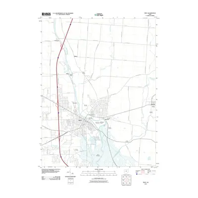
2010 Map of Troy
USGS Topo · Published 2010About this map
The Great Miami River anchors this study of the Miami County landscape, flowing past the city of Troy and several smaller agricultural communities. Significant local history is preserved at the historic Eldean Bridge and through a dense network of family and community burial grounds, including the Knoop Cemetery, Saunders Cemetery, and Raper Chapel Cemetery. These sites are distributed among rural settlements like Casstown, Staunton, and Farrington, illustrating the early township development of the region.
Find a feature on this map
46 named features on this map. Tap any name to fly to it.
Don’t see what you’re looking for? This feature index may not catch every label — zoom into the map to look around manually.
Map Details
Editions of this 2010 Troy Map
This is the sole edition of this map. No revisions or reprints were ever made.
Other maps of this area

1904 · Dayton
USGS Topo · 1:62,500

1905 · Brookville
USGS Topo · 1:62,500

1906 · Dayton
USGS Topo · 1:62,500

1911 · Covington
USGS Topo · 1:62,500

1914 · Troy
USGS Topo · 1:62,500

1944 · Covington
USGS Topo · 1:62,500

1944 · Troy
USGS Topo · 1:62,500

1953 · Cincinnati
USGS Topo · 1:250,000

1953 · Muncie
USGS Topo · 1:250,000

1955 · West Milton
USGS Topo · 1:24,000