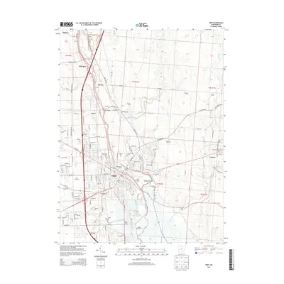
2013 Map of Troy
USGS Topo · Published 2013About this map
The Great Miami River carves a path through Miami County, anchoring the city of Troy as it expands into the surrounding agricultural landscape. This 2013 survey illustrates a transition from the dense urban core to the outlying hamlets of Casstown, Eldean, and Farrington. Along the river’s edge, the Miami County Fairgrounds and Troy Memorial Stadium highlight the city's role as a regional hub, while the historical Eldean Bridge stands as a significant landmark in the river valley.
Find a feature on this map
138 named features on this map. Tap any name to fly to it.
Don’t see what you’re looking for? This feature index may not catch every label — zoom into the map to look around manually.
Map Details
Editions of this 2013 Troy Map
This is the sole edition of this map. No revisions or reprints were ever made.
Other maps of this area

1904 · Dayton
USGS Topo · 1:62,500

1905 · Brookville
USGS Topo · 1:62,500

1906 · Dayton
USGS Topo · 1:62,500

1911 · Covington
USGS Topo · 1:62,500

1914 · Troy
USGS Topo · 1:62,500

1944 · Covington
USGS Topo · 1:62,500

1944 · Troy
USGS Topo · 1:62,500

1953 · Cincinnati
USGS Topo · 1:250,000

1953 · Muncie
USGS Topo · 1:250,000

1955 · West Milton
USGS Topo · 1:24,000