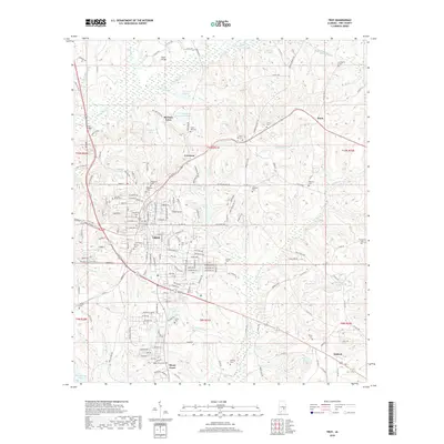
2018 Map of Troy
USGS Topo · Published 2018About this map
Troy serves as the focal point of this Pike County survey, centered around the sprawling campus of Troy Univ. The landscape reveals a complex network of residential growth and established institutions, with historical burial grounds like Oakwood Cem and Carroll Street Cem marking the city's older core. North of the city, the Conecuh River meanders through the terrain, bridged by structures such as Faulk Bridge, while smaller outlying communities like McClure Town and Corcoran maintain their distinct identities along the county roads. The southern reaches of the map shift toward a more wooded and pond-dotted landscape, where Mossy Grove and Antioch are anchored by local landmarks including Mossy Grove Cem and Walters Pond. This layout captures the area's 21st-century balance between academic expansion and its rural Alabama roots.
Find a feature on this map
145 named features on this map. Tap any name to fly to it.
Don’t see what you’re looking for? This feature index may not catch every label — zoom into the map to look around manually.
Map Details
Editions of this 2018 Troy Map
This is the sole edition of this map. No revisions or reprints were ever made.
Other maps of this area

1948 · Brundidge
USGS Topo · 1:62,500

1950 · Brundidge
USGS Topo · 1:62,500

1953 · Andalusia
USGS Topo · 1:250,000

1953 · Dothan
USGS Topo · 1:250,000

1954 · Dothan
USGS Topo · 1:250,000

1955 · Dothan
USGS Topo · 1:250,000

1957 · Andalusia
USGS Topo · 1:250,000

1960 · Brundidge
USGS Topo · 1:24,000

1960 · Brundidge NW
USGS Topo · 1:24,000

1962 · Brundidge
USGS Topo · 1:25,000