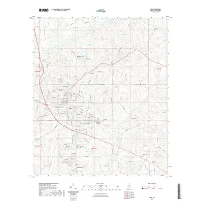
2021 Map of Troy
USGS Topo · Published 2021About this map
Troy serves as the central hub of this East Alabama landscape, anchored by the expansive campus of Troy University and the Pike County Courthouse. The town’s growth is traced through its grid of residential streets and numerous burial grounds, including the centrally located Oakwood Cem and Murphree Cem. Beyond the city limits, the terrain transitions into a mosaic of small rural communities and named water features that speak to the region's agricultural and social foundations.
Find a feature on this map
87 named features on this map. Tap any name to fly to it.
Don’t see what you’re looking for? This feature index may not catch every label — zoom into the map to look around manually.
Map Details
Editions of this 2021 Troy Map
This is the sole edition of this map. No revisions or reprints were ever made.
Other maps of this area

1948 · Brundidge
USGS Topo · 1:62,500

1950 · Brundidge
USGS Topo · 1:62,500

1953 · Andalusia
USGS Topo · 1:250,000

1953 · Dothan
USGS Topo · 1:250,000

1954 · Dothan
USGS Topo · 1:250,000

1955 · Dothan
USGS Topo · 1:250,000

1957 · Andalusia
USGS Topo · 1:250,000

1960 · Brundidge
USGS Topo · 1:24,000

1960 · Brundidge NW
USGS Topo · 1:24,000

1962 · Brundidge
USGS Topo · 1:25,000