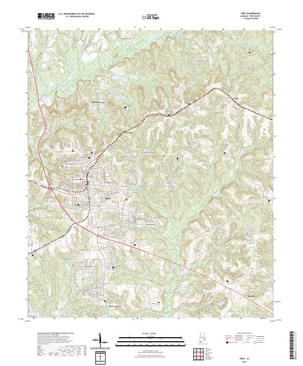
2024 Map of Troy
USGS Topo · Published 2024About this map
The Pike County Courthouse stands as the central landmark of Troy, Alabama, in this recent 2024 landscape. This modern survey illustrates the university town's footprint, reaching from the campus of Troy University out toward surrounding rural communities like Corcoran and McClure Town. The area is characterized by a high density of local burial grounds, including the Oakwood Cem near the town center and the outlying Union Hill Cem, which often represent the earliest established points of settlement in the county. Hydrological features such as Heads Pond and Morgans Pond punctuate the terrain, while the road network connects smaller settlements like Mossy Grove and Antioch. The topography reveals the transition from the organized city streets of the county seat to the winding county roads that service the agricultural and timbered lands of the surrounding hills.
Find a feature on this map
116 named features on this map. Tap any name to fly to it.
Don’t see what you’re looking for? This feature index may not catch every label — zoom into the map to look around manually.
Map Details
Editions of this 2024 Troy Map
This is the sole edition of this map. No revisions or reprints were ever made.
Other maps of this area

1948 · Brundidge
USGS Topo · 1:62,500

1950 · Brundidge
USGS Topo · 1:62,500

1953 · Andalusia
USGS Topo · 1:250,000

1953 · Dothan
USGS Topo · 1:250,000

1954 · Dothan
USGS Topo · 1:250,000

1955 · Dothan
USGS Topo · 1:250,000

1957 · Andalusia
USGS Topo · 1:250,000

1960 · Brundidge
USGS Topo · 1:24,000

1960 · Brundidge NW
USGS Topo · 1:24,000

1962 · Brundidge
USGS Topo · 1:25,000