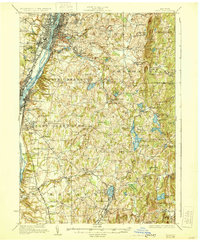
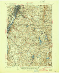
1928 Map of Troy
USGS Topo · Published 1930About this map
Rensselaer Polytechnic Institute and the Arsenal anchor the industrial and educational core of Troy and Watervliet along the banks of the Hudson River. This late 1920s landscape reveals the transition from dense urban centers to a rural hinterland defined by family-named hills and numerous community schoolhouses, such as Hidley School No 3 and Bliss School. The eastern plateau toward Grafton and Stephentown is dotted with recreational and religious sites, including YMCA Camp near Pikes Pond and the Plank Road Church.
Find a feature on this map
127 named features on this map. Tap any name to fly to it.
Don’t see what you’re looking for? This feature index may not catch every label — zoom into the map to look around manually.
Map Details
Editions of this 1928 Troy Map
5 editions found
Other maps of this area

1888 · Berlin
USGS Topo · 1:62,500

1888 · Pittsfield
USGS Topo · 1:62,500

1890 · Pittsfield
USGS Topo · 1:62,500

1890 · Berlin
USGS Topo · 1:62,500

1893 · Cohoes
USGS Topo · 1:62,500

1893 · Troy
USGS Topo · 1:62,500

1893 · Schenectady
USGS Topo · 1:62,500

1893 · Coxsackie
USGS Topo · 1:62,500

1893 · Pittsfield
USGS Topo · 1:62,500

1893 · Albany
USGS Topo · 1:62,500