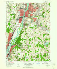
1953 Map of Troy South
USGS Topo · Published 1961About this map
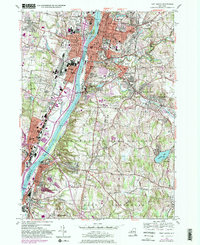
The Hudson River corridor serves as the industrial and civic spine of this region, with the massive Watervliet Arsenal and the manufacturing hub of Troy facing each other across the water. On the eastern bluffs, the Rensselaer Polytechnic Institute and Emma Willard College represent the area's established educational core, while Albany Rural Cemetery and St Agnes Cemetery create a vast institutional green space on the western heights of Menands. The landscape transitioning into North Greenbush and East Greenbush reflects a post-war shift toward suburban settlement, evidenced by the emerging residential patterns around Snyders Lake and Defreestville. This 1950s survey captures the dense rail network of the Delaware and Hudson RR before the full impact of mid-century highway expansion altered the riverfront character of Watervliet and Rensselaer.
Find a feature on this map
101 named features on this map. Tap any name to fly to it.
Don’t see what you’re looking for? This feature index may not catch every label — zoom into the map to look around manually.
Map Details
Editions of this 1953 Troy South Map
5 editions found
Other maps of this area

1893 · Cohoes
USGS Topo · 1:62,500

1893 · Troy
USGS Topo · 1:62,500

1893 · Schenectady
USGS Topo · 1:62,500

1893 · Albany
USGS Topo · 1:62,500

1895 · Troy
USGS Topo · 1:62,500

1895 · Cohoes
USGS Topo · 1:62,500

1895 · Albany
USGS Topo · 1:62,500

1895 · Schenectady
USGS Topo · 1:62,500

1898 · Schenectady
USGS Topo · 1:62,500

1898 · Albany
USGS Topo · 1:62,500