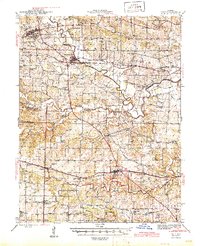
1945 Map of Troy
USGS Topo · Published 1945About this map
The Cuivre River winds through the heart of the Missouri countryside in this mid-1940s survey, marking a landscape where rural education and rail transport remained central to community life. The convergence of Lincoln, St. Charles, and Warren counties is defined by a dense network of country schools, including St Marys Sch, Owen Station Sch, and Sugar Grove Sch, many of which served farming families long before the consolidation of modern districts.
Find a feature on this map
79 named features on this map. Tap any name to fly to it.
Don’t see what you’re looking for? This feature index may not catch every label — zoom into the map to look around manually.
Map Details
Editions of this 1945 Troy Map
2 editions found

Other maps of this area

1890 · Louisiana
USGS Topo · 1:125,000

1890 · Hermann
USGS Topo · 1:125,000

1903 · O'Fallon
USGS Topo · 1:125,000

1930 · Hardin
USGS Topo · 1:62,500

1931 · Brussels
USGS Topo · 1:62,500

1934 · Elsberry
USGS Topo · 1:48,000

1934 · Hardin
USGS Topo · 1:62,500

1937 · Weldon Spring
USGS Topo · 1:24,000

1937 · Silex
USGS Topo · 1:62,500

1938 · Hardin
USGS Topo · 1:62,500