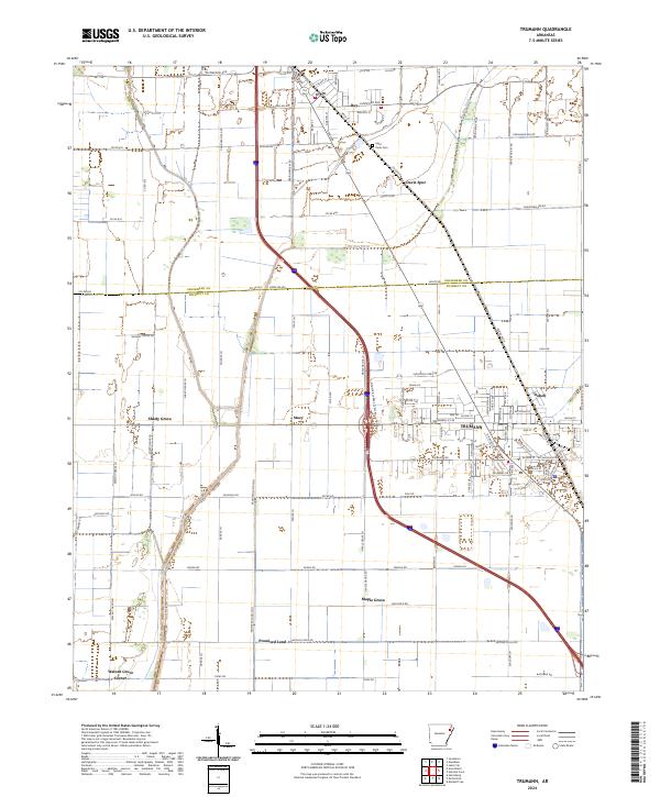
2024 Map of Trumann
USGS Topo · Published 2024About this map
The city of Trumann serves as the central hub of this Poinsett County landscape, situated where the BNSF Railway corridor intersects a complex network of local roads and agricultural drainage systems. The map illustrates a heavily managed delta environment, characterized by long, straight waterways like the Big Bay Ditch and a dense grid of rural routes. Smaller settlements and named locales such as Stacy, Dobell, and Maple Grove are scattered throughout the territory, marking the historical footprint of community nodes that evolved alongside the rail and timber industries of northeast Arkansas.
Find a feature on this map
68 named features on this map. Tap any name to fly to it.
Don’t see what you’re looking for? This feature index may not catch every label — zoom into the map to look around manually.
Map Details
Editions of this 2024 Trumann Map
This is the sole edition of this map. No revisions or reprints were ever made.
Other maps of this area

1939 · Jonesboro
USGS Topo · 1:62,500

1940 · Dee
USGS Topo · 1:62,500

1941 · Leachville
USGS Topo · 1:62,500

1941 · Marked Tree
USGS Topo · 1:62,500

1953 · Memphis
USGS Topo · 1:250,000

1956 · Leachville
USGS Topo · 1:62,500

1956 · Marked Tree
USGS Topo · 1:62,500

1956 · Memphis
USGS Topo · 1:250,000

1958 · Dee
USGS Topo · 1:62,500

1958 · Jonesboro
USGS Topo · 1:62,500