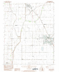
1983 Map of Trumann
USGS Topo · Published 1984About this map
Trumann serves as the primary hub of this Poinsett County landscape, showing a detailed street grid complete with the High Sch, City Hall, and several municipal parks. The surrounding territory reveals a highly managed agricultural environment, defined by an extensive network of drainage channels including Little Bay Ditch, Gum Slough Ditch, and Big Bay Ditch. These waterways allow for the cultivation of the low-lying terrain between the small settlements of Stacy and Herman.
Find a feature on this map
24 named features on this map. Tap any name to fly to it.
Don’t see what you’re looking for? This feature index may not catch every label — zoom into the map to look around manually.
Map Details
Editions of this 1983 Trumann Map
This is the sole edition of this map. No revisions or reprints were ever made.
Other maps of this area

1939 · Jonesboro
USGS Topo · 1:62,500

1940 · Dee
USGS Topo · 1:62,500

1941 · Leachville
USGS Topo · 1:62,500

1941 · Marked Tree
USGS Topo · 1:62,500

1953 · Memphis
USGS Topo · 1:250,000

1956 · Leachville
USGS Topo · 1:62,500

1956 · Marked Tree
USGS Topo · 1:62,500

1956 · Memphis
USGS Topo · 1:250,000

1958 · Dee
USGS Topo · 1:62,500

1958 · Jonesboro
USGS Topo · 1:62,500