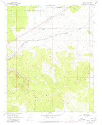
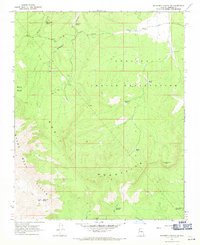
1968 Map of Truxton
USGS Topo · Published 1980About this map
Truxton sits at a critical juncture of high-desert transportation in the late 1960s, where the Atchison Topeka and Santa Fe railroad follows the natural corridor of Truxton Wash. This survey reflects the infrastructure of the era, noting both the main town and the rail-dependent Truxton (Siding). The landscape is defined by its transition from the northern Hualapai Indian Reservation into the dramatic elevation changes of the Cottonwood Cliffs.
Find a feature on this map
16 named features on this map. Tap any name to fly to it.
Don’t see what you’re looking for? This feature index may not catch every label — zoom into the map to look around manually.
Map Details
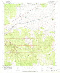
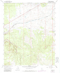
Editions of this 1968 Truxton Map
3 editions found
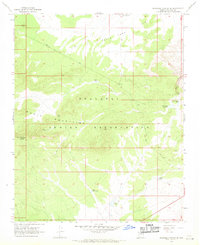
Other maps of this area

1886 · Diamond Creek
USGS Topo · 1:250,000

1892 · Diamond Creek
USGS Topo · 1:250,000

1948 · Williams
USGS Topo · 1:250,000

1954 · Williams
USGS Topo · 1:250,000

1956 · Williams
USGS Topo · 1:250,000

1960 · Williams
USGS Topo · 1:250,000

1961 · Williams
USGS Topo · 1:250,000
1967 · Milkweed Canyon SE
USGS Topo · 1:24,000
1967 · Milkweed Canyon SW
USGS Topo · 1:24,000
1967 · Peach Springs
USGS Topo · 1:24,000