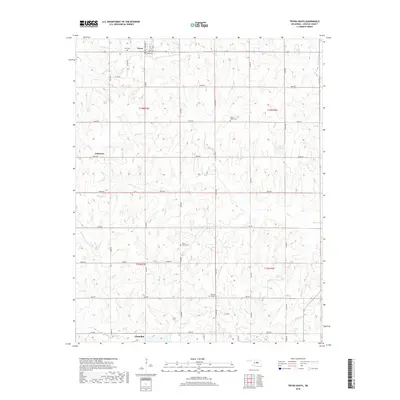
2018 Map of Tryon South
USGS Topo · Published 2018About this map
Tryon and the northern outskirts of Chandler anchor this section of Lincoln County, where the landscape is defined by the headwaters of numerous small creeks. The terrain is notably dissected by watercourses such as Bellcow Cr, Olive Cr, and Sand Cr, which flow through a network of sections organized by the Public Land Survey System. Historically significant burial sites are scattered throughout these townships, including Valley Queen Cem and Rock Spring Cem, providing vital reference points for local genealogy. Between the established towns, the small settlement of Anderson sits along the section lines. The map reveals a transition from the structured street grid of Tryon, featuring Central and Birch Ave, to the broader rural expanse characterized by a dense grid of county roads such as N3400 Rd and E0850 Rd.
Find a feature on this map
48 named features on this map. Tap any name to fly to it.
Don’t see what you’re looking for? This feature index may not catch every label — zoom into the map to look around manually.
Map Details
Editions of this 2018 Tryon South Map
This is the sole edition of this map. No revisions or reprints were ever made.
Other maps of this area

1905 · Chandler
USGS Topo · 1:62,500

1907 · Chandler
USGS Topo · 1:62,500

1908 · Agra
USGS Topo · 1:62,500

1909 · Luther
USGS Topo · 1:62,500

1909 · Perkins
USGS Topo · 1:62,500

1954 · Oklahoma City
USGS Topo · 1:250,000

1957 · Oklahoma City
USGS Topo · 1:250,000

1963 · Oklahoma City
USGS Topo · 1:250,000
1966 · Wellston
USGS Topo · 1:24,000
1974 · Chandler
USGS Topo · 1:24,000