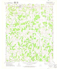
1975 Map of Tryon South
USGS Topo · Published 1979About this map
Tryon serves as the primary northern hub of this mid-1970s Lincoln County landscape, situated where the Missouri - Kansas - Texas railroad line intersects with local rural routes. The map illustrates a region defined by its energy and transportation history, featuring numerous Oil Wells, a prominent Pipeline, and an Oil Field extending across the central townships. Small rural congregations and their histories are anchored by landmarks like Rock Spring Cem and Pleasant Ridge Ch.
Find a feature on this map
28 named features on this map. Tap any name to fly to it.
Don’t see what you’re looking for? This feature index may not catch every label — zoom into the map to look around manually.
Map Details
Editions of this 1975 Tryon South Map
This is the sole edition of this map. No revisions or reprints were ever made.
Other maps of this area

1905 · Chandler
USGS Topo · 1:62,500

1907 · Chandler
USGS Topo · 1:62,500

1908 · Agra
USGS Topo · 1:62,500

1909 · Luther
USGS Topo · 1:62,500

1909 · Perkins
USGS Topo · 1:62,500

1954 · Oklahoma City
USGS Topo · 1:250,000

1957 · Oklahoma City
USGS Topo · 1:250,000

1963 · Oklahoma City
USGS Topo · 1:250,000
1966 · Wellston
USGS Topo · 1:24,000
1974 · Chandler
USGS Topo · 1:24,000