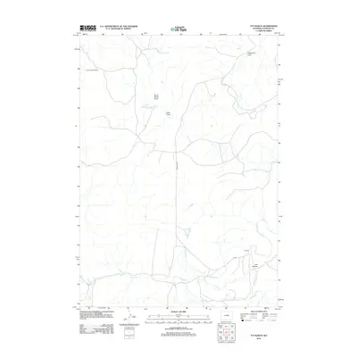
2012 Map of TTT Ranch
USGS Topo · Published 2012About this map
The TTT Ranch and the Roy Rinker Homestead anchor this high plains landscape in southern Johnson County. The map details an arid environment defined by seasonal drainages and irrigation infrastructure, notably the Tisdale Ditch which cuts across the central terrain. Water management is a primary theme of the region's ranching economy, visible in the placement of King Reservoir and the winding course of the S Fork Powder River in the southeast. Named topographic features like Telephone Draw, North Sandy Draw, and Lucky Draw illustrate the complex system of natural conduits that shape the local geography. In the south, Posey Creek and Willow Creek converge near the rugged breaks of Trail Canyon, while a network of rural routes including Lone Bear Rd and TTT Rd provide the essential transit links between these isolated homesteads.
Find a feature on this map
13 named features on this map. Tap any name to fly to it.
Don’t see what you’re looking for? This feature index may not catch every label — zoom into the map to look around manually.
Map Details
Editions of this 2012 TTT Ranch Map
This is the sole edition of this map. No revisions or reprints were ever made.
Other maps of this area

1955 · Arminto
USGS Topo · 1:250,000

1958 · Arminto
USGS Topo · 1:250,000

1961 · Barnum
USGS Topo · 1:62,500

1961 · Kaycee NE
USGS Topo · 1:24,000

1961 · TTT Ranch
USGS Topo · 1:24,000

1961 · Wall Creek
USGS Topo · 1:24,000

1961 · Kaycee
USGS Topo · 1:24,000

1962 · Arminto
USGS Topo · 1:250,000

1968 · Willow Creek School
USGS Topo · 1:24,000

1968 · Salt Canyon
USGS Topo · 1:24,000