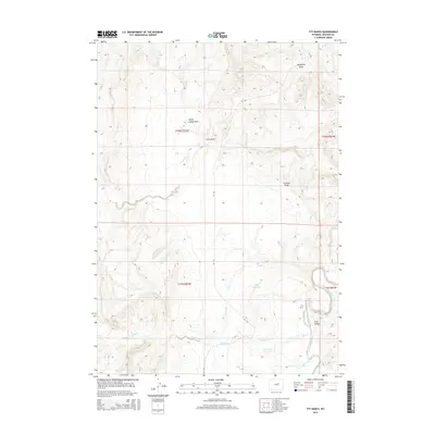
2015 Map of TTT Ranch
USGS Topo · Published 2015About this map
The TTT Ranch and its surrounding landscape in Johnson County are defined by a sophisticated system of water management and natural drainage ways. The S Fork Powder River snakes through the eastern edge of the map, fed by local tributaries like Willow Cr and Posey Creek. This rangeland is marked by human engineering, specifically the Tisdale Ditch and Ellis Reservoir, which are vital for supporting life and agriculture in this semi-arid environment. The terrain is deeply grooved by numerous named draws, including Telephone Draw, North Sandy Draw, and Frewens Draw, which highlight the natural erosion patterns of the area. Connectivity is limited to the winding TTT RD, emphasizing the focus on ranching operations and water access. Significant topographical features like Trail Canyon and Lucky Draw provide clear landmarks for navigating the high plains geography of central Wyoming.
Find a feature on this map
17 named features on this map. Tap any name to fly to it.
Don’t see what you’re looking for? This feature index may not catch every label — zoom into the map to look around manually.
Map Details
Editions of this 2015 TTT Ranch Map
This is the sole edition of this map. No revisions or reprints were ever made.
Other maps of this area

1955 · Arminto
USGS Topo · 1:250,000

1958 · Arminto
USGS Topo · 1:250,000

1961 · Barnum
USGS Topo · 1:62,500

1961 · Kaycee NE
USGS Topo · 1:24,000

1961 · TTT Ranch
USGS Topo · 1:24,000

1961 · Wall Creek
USGS Topo · 1:24,000

1961 · Kaycee
USGS Topo · 1:24,000

1962 · Arminto
USGS Topo · 1:250,000

1968 · Willow Creek School
USGS Topo · 1:24,000

1968 · Salt Canyon
USGS Topo · 1:24,000