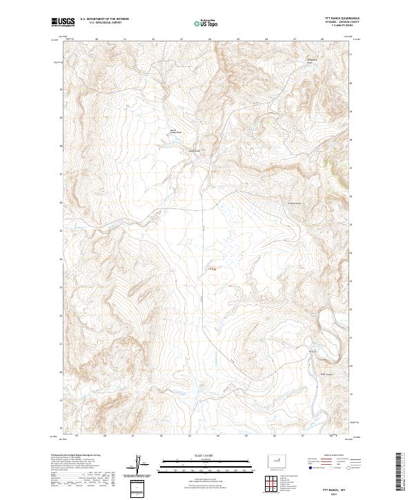
2021 Map of TTT Ranch
USGS Topo · Published 2021About this map
TTT Ranch sits in the rugged basin of the S Fork Powder River in Johnson County, illustrating a landscape defined by ranching history and ephemeral water management. The terrain is deeply incised by a network of drainage features including Telephone Draw, Frewens Draw, and Lucky Draw, which feed into major seasonal watercourses. Ranching infrastructure is evident through the naming of the TTT Rd and the presence of water control features like the Tisdale Ditch and King Reservoir. These landmarks, along with the meandering paths of Murphy Creek and Posey Creek, reflect the persistent effort to harness water in this arid Wyoming landscape. This modern survey provides clear documentation of traditional land divisions, including T42N R82W and T41N R81W, preserving the geographical context of this historic cattle country.
Find a feature on this map
19 named features on this map. Tap any name to fly to it.
Don’t see what you’re looking for? This feature index may not catch every label — zoom into the map to look around manually.
Map Details
Editions of this 2021 TTT Ranch Map
This is the sole edition of this map. No revisions or reprints were ever made.
Other maps of this area

1955 · Arminto
USGS Topo · 1:250,000

1958 · Arminto
USGS Topo · 1:250,000

1961 · Barnum
USGS Topo · 1:62,500

1961 · Kaycee NE
USGS Topo · 1:24,000

1961 · TTT Ranch
USGS Topo · 1:24,000

1961 · Wall Creek
USGS Topo · 1:24,000

1961 · Kaycee
USGS Topo · 1:24,000

1962 · Arminto
USGS Topo · 1:250,000

1968 · Willow Creek School
USGS Topo · 1:24,000

1968 · Salt Canyon
USGS Topo · 1:24,000