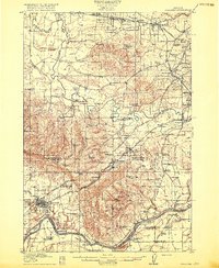
1916 Map of Tualatin
USGS Topo · Published 1916About this map
The Willamette River and Tualatin River carve a complex landscape of valley floors and steep ridges like Cooper Mountain and Bull Mtn in this 1914 survey. This era is defined by a dense network of one-room schoolhouses, such as Buckhaven School and Laurel Ridge School, serving scattered rural farming communities before the mid-century consolidation of districts. The presence of the Champoeg Monument marks the site of the 1843 provisional government meetings, anchoring the map in early Oregon history.
Find a feature on this map
107 named features on this map. Tap any name to fly to it.
Don’t see what you’re looking for? This feature index may not catch every label — zoom into the map to look around manually.
Map Details
Editions of this 1916 Tualatin Map
5 editions found
Other maps of this area

1897 · Portland
USGS Topo · 1:62,500

1905 · Portland
USGS Topo · 1:62,500

1914 · Oregon City
USGS Topo · 1:62,500

1915 · Hillsboro
USGS Topo · 1:62,500

1916 · Tualatin
USGS Topo · 1:62,500

1918 · Hillsboro
USGS Topo · 1:62,500

1923 · Mount Angel
USGS Topo · 1:62,500

1924 · Mc Minnville
USGS Topo · 1:48,000

1926 · Mc Minnville
USGS Topo · 1:62,500

1939 · Molalla
USGS Topo · 1:62,500