1916 Map of Tualatin
USGS Topo · Published 1943About this map
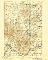
The Tualatin Valley is depicted here as a landscape of established agriculture and emerging rail suburbs during the early twentieth century. Extensive wetland systems like Onion Flat and the meandering Tualatin River are framed by prominent elevations, including Cooper Mountain and Chehalem Mountain. The presence of the Southern Pacific and Oregon Electric railroads highlights the region's connectivity, serving small communities such as Beaverton, Tigard, and Newberg.
Find a feature on this map
104 named features on this map. Tap any name to fly to it.
Don’t see what you’re looking for? This feature index may not catch every label — zoom into the map to look around manually.
Map Details
Editions of this 1916 Tualatin Map
5 editions found
Other maps of this area

1897 · Portland
USGS Topo · 1:62,500

1905 · Portland
USGS Topo · 1:62,500

1914 · Oregon City
USGS Topo · 1:62,500

1915 · Hillsboro
USGS Topo · 1:62,500

1916 · Tualatin
USGS Topo · 1:62,500

1918 · Hillsboro
USGS Topo · 1:62,500

1923 · Mount Angel
USGS Topo · 1:62,500

1924 · Mc Minnville
USGS Topo · 1:48,000

1926 · Mc Minnville
USGS Topo · 1:62,500

1939 · Molalla
USGS Topo · 1:62,500