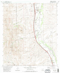
1981 Map of Tubac
USGS Topo · Published 1986About this map
The Santa Cruz River valley near the Arizona-Mexico border serves as a historic corridor of settlement and preservation in this 1981 survey. At the heart of the map lies the Tubac Presidio State Historical Park, marking the site of the oldest European settlement in Arizona. Further south along the river, the Tumacacori National Monument protects the Spanish colonial mission site near Tumacacori. The landscape is a mix of agricultural river bottom and the rising slopes of the Tumacacori Mountains to the west, where many family-named landmarks such as Kenyon Ranch and El Canto Ranch are situated.
Find a feature on this map
49 named features on this map. Tap any name to fly to it.
Don’t see what you’re looking for? This feature index may not catch every label — zoom into the map to look around manually.
Map Details
Editions of this 1981 Tubac Map
3 editions found
Other maps of this area

1904 · Patagonia
USGS Topo · 1:125,000

1905 · Patagonia
USGS Topo · 1:125,000

1905 · Nogales
USGS Topo · 1:125,000

1920 · Arivaca
USGS Topo · 1:125,000

1921 · Old Glory
USGS Topo · 1:125,000

1922 · Agus Caliente
USGS Topo · 1:62,500

1933 · Calabasas
USGS Topo · 1:62,500

1939 · Tubac
USGS Topo · 1:62,500

1942 · Ruby
USGS Topo · 1:62,500

1943 · Old Glory
USGS Topo · 1:125,000