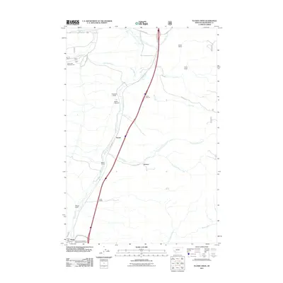
2011 Map of Tucker Creek
USGS Topo · Published 2011About this map
Divide and the nearby Divide Post Office sit at the southern edge of this landscape, where the Montana State Highway Department Section House marks the intersection of local infrastructure and mountain geography. The Interstate corridor follows the path of Divide Creek, flanked by a series of named drainages including Willow Gulch and Lime Gulch. To the north, the terrain is defined by the headwaters of several streams, notably Crazy Swede Creek and its associated South Fork Reservoir Dam. Small settlements and named locales like Woodin, Johnson, and Butler Meadow appear as established points along the valley floor. The map details the drainage network feeding into the Big Hole River system, with numerous gulches like Climax Gulch and Curly Gulch carving into the higher elevations east of the highway.
Find a feature on this map
30 named features on this map. Tap any name to fly to it.
Don’t see what you’re looking for? This feature index may not catch every label — zoom into the map to look around manually.
Map Details
Editions of this 2011 Tucker Creek Map
This is the sole edition of this map. No revisions or reprints were ever made.
Other maps of this area

1893 · Dillon
USGS Topo · 1:250,000

1955 · Dillon
USGS Topo · 1:250,000

1957 · Dillon
USGS Topo · 1:250,000

1958 · Dillon
USGS Topo · 1:250,000

1958 · Vipond Park
USGS Topo · 1:62,500

1961 · Melrose
USGS Topo · 1:24,000
1961 · Burnt Mountain
USGS Topo · 1:24,000

1961 · Wickiup Creek
USGS Topo · 1:24,000

1961 · Butte South
USGS Topo · 1:62,500

1961 · Dewey
USGS Topo · 1:24,000