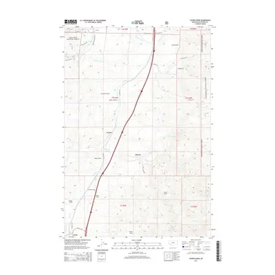
2014 Map of Tucker Creek
USGS Topo · Published 2014About this map
Deerlodge National Forest encompasses much of this terrain south of Butte, where the high country is defined by steep drainages and isolated meadowlands. The landscape transitions from the high peaks near Fleecer Ridge down to the small settlements of Woodin and Johnson, which sit along the primary north-south transport corridor. The drainage patterns are intricate here, with Crazy Swede Cr and Fly Cr carving through deep gulches like Freezeout Gulch and Climax Gulch.
Find a feature on this map
39 named features on this map. Tap any name to fly to it.
Don’t see what you’re looking for? This feature index may not catch every label — zoom into the map to look around manually.
Map Details
Editions of this 2014 Tucker Creek Map
This is the sole edition of this map. No revisions or reprints were ever made.
Other maps of this area

1893 · Dillon
USGS Topo · 1:250,000

1955 · Dillon
USGS Topo · 1:250,000

1957 · Dillon
USGS Topo · 1:250,000

1958 · Dillon
USGS Topo · 1:250,000

1958 · Vipond Park
USGS Topo · 1:62,500

1961 · Melrose
USGS Topo · 1:24,000
1961 · Burnt Mountain
USGS Topo · 1:24,000

1961 · Wickiup Creek
USGS Topo · 1:24,000

1961 · Butte South
USGS Topo · 1:62,500

1961 · Dewey
USGS Topo · 1:24,000