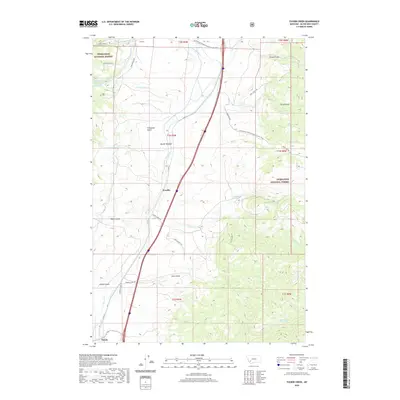
2020 Map of Tucker Creek
USGS Topo · Published 2020About this map
Woodin and Divide anchor the transportation corridor where Interstate 15 and St Hwy 91 parallel the flow of Divide Cr. This high-altitude landscape in Deerlodge National Forest is defined by the continental divide itself, with the Continental Divide National Scenic Trail winding through the northern and eastern ridges. The drainage patterns are intricate, featuring named waters such as Tucker Cr, Moose Cr, and Crazy Swede Cr.
Find a feature on this map
38 named features on this map. Tap any name to fly to it.
Don’t see what you’re looking for? This feature index may not catch every label — zoom into the map to look around manually.
Map Details
Editions of this 2020 Tucker Creek Map
This is the sole edition of this map. No revisions or reprints were ever made.
Other maps of this area

1893 · Dillon
USGS Topo · 1:250,000

1955 · Dillon
USGS Topo · 1:250,000

1957 · Dillon
USGS Topo · 1:250,000

1958 · Dillon
USGS Topo · 1:250,000

1958 · Vipond Park
USGS Topo · 1:62,500

1961 · Melrose
USGS Topo · 1:24,000
1961 · Burnt Mountain
USGS Topo · 1:24,000

1961 · Wickiup Creek
USGS Topo · 1:24,000

1961 · Butte South
USGS Topo · 1:62,500

1961 · Dewey
USGS Topo · 1:24,000