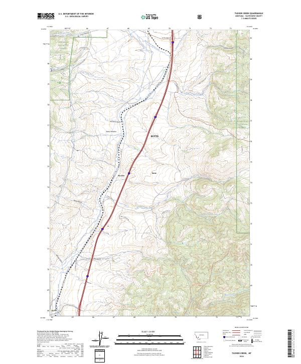
2024 Map of Tucker Creek
USGS Topo · Published 2024About this map
Deerlodge National Forest dominates this landscape along the continental divide, where steep ridges and deep gulches define the local geography. The area serves as a critical corridor for both wilderness and transit, anchored by the Continental Divide National Scenic Trl which traverses the high ground of Fleecer Ridge. In the lower elevations, the small settlement of Woodin sits near the winding path of North Fork Divide Creek, while Divide marks the southwestern extent of the map.
Find a feature on this map
37 named features on this map. Tap any name to fly to it.
Don’t see what you’re looking for? This feature index may not catch every label — zoom into the map to look around manually.
Map Details
Editions of this 2024 Tucker Creek Map
This is the sole edition of this map. No revisions or reprints were ever made.
Other maps of this area

1893 · Dillon
USGS Topo · 1:250,000

1955 · Dillon
USGS Topo · 1:250,000

1957 · Dillon
USGS Topo · 1:250,000

1958 · Dillon
USGS Topo · 1:250,000

1958 · Vipond Park
USGS Topo · 1:62,500

1961 · Melrose
USGS Topo · 1:24,000
1961 · Burnt Mountain
USGS Topo · 1:24,000

1961 · Wickiup Creek
USGS Topo · 1:24,000

1961 · Butte South
USGS Topo · 1:62,500

1961 · Dewey
USGS Topo · 1:24,000