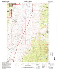
1996 Map of Tucker Creek
USGS Topo · Published 1998About this map
Deerlodge National Forest and specialized wildlife zones dominate this landscape south of Divide, captured during a 1996 update. The terrain is defined by a dense network of drainages including Tucker Creek, Crazy Swede Creek, and Fly Creek, showing a land managed for both conservation and resource extraction. Evidence of mining activity is scattered across the slopes, from a Mine Dump and Quarry near Lime Gulch to numerous unnamed prospects and adits tucked into the gulches. An extensive aqueduct system winds through the northern sections, tracing the contours alongside the North Fork Divide Creek. The presence of the Fleecer Guard Station and the High Rye State Wildlife Management Area underscores the region's focus on public land administration and habitat preservation during the late twentieth century.
Find a feature on this map
31 named features on this map. Tap any name to fly to it.
Don’t see what you’re looking for? This feature index may not catch every label — zoom into the map to look around manually.
Map Details
Editions of this 1996 Tucker Creek Map
This is the sole edition of this map. No revisions or reprints were ever made.
Other maps of this area

1893 · Dillon
USGS Topo · 1:250,000

1955 · Dillon
USGS Topo · 1:250,000

1957 · Dillon
USGS Topo · 1:250,000

1958 · Dillon
USGS Topo · 1:250,000

1958 · Vipond Park
USGS Topo · 1:62,500

1961 · Melrose
USGS Topo · 1:24,000
1961 · Burnt Mountain
USGS Topo · 1:24,000

1961 · Wickiup Creek
USGS Topo · 1:24,000

1961 · Butte South
USGS Topo · 1:62,500

1961 · Dewey
USGS Topo · 1:24,000