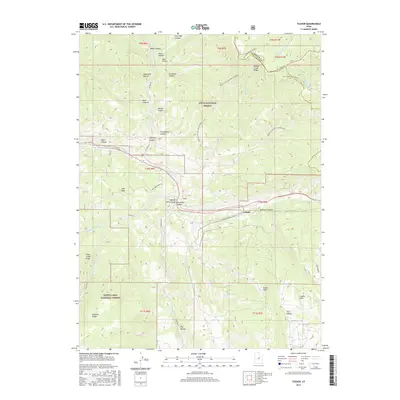
2017 Map of Tucker
USGS Topo · Published 2017About this map
Spanish Fork Canyon serves as a central corridor for this mountain landscape, where the settlements of Tucker and Gilluly are situated along the drainage of Soldier Cr. The terrain is deeply incised by a network of drainage systems, including Starvation Canyon, Davidson Canyon, and the Left Fork White River. This 2017 survey shows the convergence of major public lands, with the Uinta National Forest occupying the northern half and the Manti-LaSal National Forest extending to the south. Historically significant named landforms like Soberville Hollow, Drunkard Hollow, and Mine Hollow provide clues to early land use and local nomenclature. High-elevation vantage points such as High Peak and Tucker Peak oversee the rugged topography, while routes like Skyline Dr and Tie Fork Rd navigate the steep ridges and canyon floors.
Find a feature on this map
51 named features on this map. Tap any name to fly to it.
Don’t see what you’re looking for? This feature index may not catch every label — zoom into the map to look around manually.
Map Details
Editions of this 2017 Tucker Map
This is the sole edition of this map. No revisions or reprints were ever made.
Other maps of this area

1885 · Salt Lake
USGS Topo · 1:250,000

1885 · Manti
USGS Topo · 1:250,000

1895 · Manti
USGS Topo · 1:250,000

1907 · Strawberry Valley
USGS Topo · 1:125,000

1909 · Strawberry Valley
USGS Topo · 1:125,000

1939 · Soldier Summit
USGS Topo · 1:62,500

1942 · Soldier Summit
USGS Topo · 1:62,500

1954 · Salt Lake City
USGS Topo · 1:250,000

1956 · Price
USGS Topo · 1:250,000

1958 · Salt Lake City
USGS Topo · 1:250,000