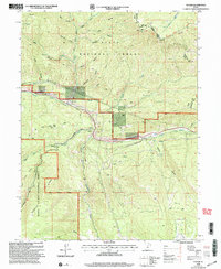
2001 Map of Tucker
USGS Topo · Published 2004About this map
Uinta National Forest and Manti La Sal National Forest converge at the heart of this high-altitude landscape in central Utah. The map traces the corridor of Spanish Fork Canyon, where the settlement of Tucker and the nearby Sky View cluster along the transportation route. The presence of a small Cem and a Rest Area near Tucker suggests the location's historical importance as a stop for travelers moving through the mountain passes.
Find a feature on this map
42 named features on this map. Tap any name to fly to it.
Don’t see what you’re looking for? This feature index may not catch every label — zoom into the map to look around manually.
Map Details
Editions of this 2001 Tucker Map
This is the sole edition of this map. No revisions or reprints were ever made.
Other maps of this area

1885 · Salt Lake
USGS Topo · 1:250,000

1885 · Manti
USGS Topo · 1:250,000

1895 · Manti
USGS Topo · 1:250,000

1907 · Strawberry Valley
USGS Topo · 1:125,000

1909 · Strawberry Valley
USGS Topo · 1:125,000

1939 · Soldier Summit
USGS Topo · 1:62,500

1942 · Soldier Summit
USGS Topo · 1:62,500

1954 · Salt Lake City
USGS Topo · 1:250,000

1956 · Price
USGS Topo · 1:250,000

1958 · Salt Lake City
USGS Topo · 1:250,000